Tools & Strategies

Based on dialogue and reflections with 55 GIA participant organizations about their conservation strategies with regard to infrastructure projects in four regions, GIA produced a preliminary assessment of the effectiveness of different conservation strategies. We found that the following approaches, specifically aimed at reducing power inequalities that characterize business-as-usual infrastructure planning and implementation, offer promising opportunities for positively influencing infrastructure governance:

● Integrated conservation strategies — incorporating communication and protest, law enforcement, and legal and policy approaches — aimed at political mobilization and negotiation.
● Potential synergies between grassroots organizations and other kinds of organizations.
● Complementary conservation actions, such as research and capacity-building, that support and strengthen the previously listed conservation strategies.

Please, download Tools and Strategies Report and Infographic below:

Analysis - Tools & Strategies

Non-Criminal Legal Action

GIA’s Working Group on conservation strategy 4.3, “non-criminal legal action,” aims to empower local actors to defend their territories and human rights from threats of infrastructure projects.  By developing simple and accessible tools, we intend to support indigenous and traditional organizations and leaders to select and use legal strategies and instruments, increasing their ability to take and support judicial action.

The Working Group is led by UF, IEB, and the Legal Clinic at the UNIR Law School and is open to any GIA collaborators interested in this theme.

Ongoing activities include (i) discussion of concepts and practical examples to develop a shared understanding within the group. And (ii) a survey of national and international legislation and other legal tools of infrastructure governance.  The Working Group will then undertake analysis of the existing legal framework and recurrent legal issues and create a Virtual Repository of:

  • Brazilian and international legislation;
  • Judicial decisions from national and international fora and venues;
  • A reference list of petitions; and
  • A checklist for producing evidence and proof.

These materials and resources will be used to carry out capacity-building activities and produce communication tools, such as videos and fliers, to empower local actors.  Finally, a teaching-learning Platform will be established to facilitate the exchange of experiences and expansion of this initiative from the Southern Amazonas – Northern Rondonia mosaic to other regions in the GIA pan-Amazon Community of Practice and Learning.

Awareness Raising

The CMP3 working group strives to help GIA meet its goal to support our network of partners by using communication tools to build a successful communication plan that translates into action. The CMP3 group has been conducting an assessment of our partners’ experiences and communication approaches to create a better understanding of the similarities and differences that our partners share. The working group will soon be hosting round-table discussions to help every organization improve its communication strategy.

To better understand the impact of communication strategies, GIA focused on innovative communication experiences (workshops, dialogues, podcasts, radio stations and / or other media) used by its partners and convened project partner organizations that include organizations NGOs, grassroots organizations, civil society organizations, and indigenous groups to participate in a preliminary study. The initial objective was to generate, together with the partners, information on innovative communication strategies practiced by these organizations and that had potential to be translated into action and transformation of the infrastructure governance processes in their regions.

The rapid evaluation of the communication strategies used by 14 partner organizations specifically synthesized information on the objectives of the strategy, the target audience, the instruments, the actions, the desired impacts, and the limiting and facilitating factors of the effectiveness of the strategy.

In a complementary manner, four spaces for reflection (round-table discussions one in each region and one summoning all partners) were organized between December 2020 and April 2021 with partner organizations.

The rapid evaluation process allowed the partners to reflect on their own strategies, their level of innovation and desired impact, the strengths of these strategies that contribute to their effectiveness, and the limiting factors exposed. The talks provided a space for the exchange of innovative experiences and dialogue on common objectives for political advocacy.

The results of these activities have been summarized in two interactive products:

Infographics — access here or click in the image

ArcGIS Story Maps –access here or click in the image

Let us know your reflections on these two products on our knowledge exchange page, click here.

We welcome contributions of relevant experiences and lessons, and invite GIA participants who are interested to join either of these working groups.

Stakeholder Analysis

Faculty Coordinators: Simone Athayde, Robert Buschbacher and Andrea Birgit Chavez.
GIA Students/researchers/co-leaders: Angelica Gouveia Nunes, Alexandra Sabo, Felipe Gutierrez, Juliana Santiago, Marliz Arteaga, Pamela Montero Alvarez, Sinomar Ferreira da Fonseca Junior, and Vanessa Luna Celino.
Partners: Cecilia Sanjinez (UAP/Bolivia); Daniela Gomes Pinto, Kena Azevedo Chaves and Leticia Ferrero Artuso (FGV/Brazil); Henrique Santiago (WWF/Brazil) and collaborators; and Rodrigo Botero Garcia and Maryi Adriana Serrano (FCDS/Colombia).

The GIA Working Group on Stakeholder Analysis (SA) has been meeting regularly since June 2019, and is carrying out a systematic literature review on Stakeholder Analysis applied to Infrastructure Governance in the Amazon, highlighting diverse methods and tools that can be used for identifying, engaging, and investigating relationships among stakeholders. SA as an approach with diverse theoretical streams, methods and tools has several applications in environmental governance, such as:

a) facilitate flow of information and collaboration among actors and GIA participant projects;
b) inform the development of strategies to pursue and manage diverse social actors towards reconciling conservation and development;
c) manage conflicts;
d) facilitate communication and transparent implementation of decisions; and
e) understand policy context and assess the feasibility of policy options.

GIA Stakeholder Analysis Working Group

GIA Stakeholder Analysis Working Group

The collaborative learning process initially developed among GIA faculty and students was expanded to cooperation with GIA partners in the focal mosaics in Bolivia, Peru, Colombia and Brazil, plus a case-study on the Belo Monte hydroelectric dam. This expanded group is working on an illustrated E-book to be published in English, Spanish and Portuguese in the Fall of 2020, with accompanying on-line materials and webinars. This book will include: a literature review article along with a collection of methods and tools; and five case-studies documenting approaches to multi-stakeholder processes, territorial and/or infrastructure governance. The case studies in preparation are:

1) Application of SA as a tool for community empowerment in the Brazil-Bolivia binational area, focusing on hydropower development in the Madeira river;
2) Stakeholder engagement in planning in the “Marginal de la Selva” highway in Colombia;
3) Monitoring the development of the "Aliança pelo Desenvolvimento Sustentável do Sul do Amazonas" in Brazil multi-stakeholder network (territorial governance);

4) Unpacking institutional collaboration for infrastructure governance in the Loreto region, Peru; and
5) Stakeholder analysis and engagement for development of a monitoring tool addressing the social and environmental impacts of the Belo Monte dam in the Xingu River, Brazilian Amazon.

Timeline

Historical timelines are a way to focus on the drivers of system change and decision-making processes, helping us to reflect on when major policy shifts occurred and what were critical enabling and limiting factors. We present the regional timelines here, with reflection on the scale at which key events occurred, the roles of different actors in catalyzing system change, what was emphasized by the participant group, apparent gaps in the workshop reflections, key lessons, and potential avenues for further work. The cross-regional synthesis of timelines may be found here.

The wisdom of hindsight: a comparative analysis of timelines of environmental governance of infrastructure across the Pan-Amazon

Please, click on the image to access the full document.

Colombia
Mosaic

timeline Colombia Mosaic

Please, click on the image to download it.

Upper Madera
Mosaic

timeline upper madera

Please, click on the image to download it.

Loreto
Mosaic

timeline Loreto Mosaic

Please, click on the image to download it.

Southern Amazonas – Northern Rondônia, Brazil

timeline Southern Amazonas – Northern Rondônia, Brazil

Please, click on the image to download it.

Participatory Mapping

The Participatory Mapping analysis assesses how geospatial datasets enable the comparison and understanding of areas of key value, concern and recommended actions within GIA's Community of Practice and Learning.

Faculty Coordinators: Eben Broadbent, Angelica Almeyda Zambrano, Bette Loiselle and Andrea Birgit Chavez.
GIA Students/Researchers/Co-leaders: Carla Mere, Eduardo Bongiolo, Felipe Gutierrez, Gabriel Cardoso Carrero, Marliz Arteaga, and Vanessa Luna Celino.

The GIA Working Group on Geospatial Research and Participatory Mapping has been meeting regularly since March 2019 and has developed a participatory mapping exercise which was implemented during four regional workshops in the mosaics of Loreto-Peru, Southern Amazon/Northern Rondônia -Brazil, Upper Madera - Bolivia, and Colombian Amazon - Colombia. The exercise served as a stakeholder interactive mapping approach to identify from a personal or institutional perspective (a) areas of concerns stemming from infrastructure projects, with particular interest for areas in and around protected areas, (b) areas of value characterized by biophysical, social, cultural, economic, and holistic attributes, (c) recommendations conducted or addressed by each regional institution and stakeholder, as well as identified needs and/or opportunities. A total of 117 stakeholders attended these workshops, which included representatives of the governments, non-profit organizations (NGOs), grassroots organizations, indigenous and traditional communities, and academia.

The group has been working on an academic manuscript based on the workshop exercises. The analysis employs textual and spatial analysis and shows how participatory mapping can be used as a tool to visualize and reflect on (1) areas of value, (2) areas of concern, and (3) recommended actions in the context of a Community of Practice and Learning (CoP-L) aimed at reducing infrastructure impacts and supporting governance processes in Amazonia. The study will further shed light on the strength and weaknesses of the participatory mapping approach in this exercise and with implications for infrastructure and other environmental governance projects in Amazonia and elsewhere. We believe that by sharing local-knowledge-driven data and strengthening multi-actor dialogue and collaboration, this novel approach can improve day to day practices of CoP-L members and improve the transparency of infrastructure planning and good governance.

Other Activities of the Group
The group has developed a one-day 8-hour drone capacity building workshop focused on monitoring and evaluation of infrastructure governance in the Amazon in each mosaic. The training has been done in three mosaics (Loreto-Peru, Southern Amazon/Northern Rondônia -Brazil, and Upper Madera-Bolivia) in 2019 and trained participants on drone use, development of automated flight plans, post collection analysis of data, with a focus on imagery and videos for monitoring and governance.
ArcGIS Online Interactive Platform

We developed an ArcGIS online interactive map platform that integrates all data obtained during the map exercises. The maps below include each geographic feature (represented by polygon shape files) drawn by each participant carefully digitalized in the concern and value layers. Results of the participatory map exercise are distinguished by macro-region (mosaics).
To facilitate the visualization at the beginning, some layers are only visible when the map loads and when selected. Scroll through the layers and select the layers you want to see by opening the layer tab (second button under the map name). Some additional layers are available for comparison such as roads, rivers, deforestation, and other. You can also open the legend tab (first button under the map name). To analyze the content, click on the map and explore each shape file by clicking on the points. Explore the interactive mapping platform!

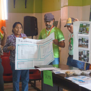
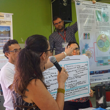
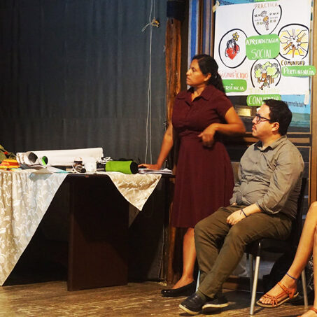
Stakeholders and GIA Team during a participatory mapping exercise.

Download
Data

Participatory-mapping-digitalization_3

Please, click on the image to download it.

Participatory Mapping for Strengthening Environmental Governance on Socio-Ecological Impacts of Infrastructure in the Amazon: Lessons to Improve Tools and Strategies

Please, click on the image to download it.

Analysis of Case Studies with More Effective Outcomes

Our preliminary assessment of conservation strategies identified several promising cases that offer opportunities for analysis and learning. This research aims to assess how power, political mobilization, collaboration, and the governance context influence the effectiveness of conservation strategies to promote infrastructure governance. It comparatively analyzes an emblematic case across mosaics. To access the summary and final draft of the analysis visit the following documents:

Organizational Analysis

To reflect on the strengths and weaknesses created by new and emergent issues related to infrastructure projects, the GIA project identified a group of focal conservation organizations fostering an ample set of relationships and experiences in the four Amazonian Regions: Bolivia (Alto Madeira), Brazil (Rondônia and Amazonas), Colombia (Caquetá) and Perú (Loreto), to conduct a comparative analysis in terms of their collaborative ties and conservation strategies. We used Social Network Analysis to understand how these organizations work collectively, thus going beyond individual examination and recognizing the role of collective action and collaboration in complex socio-ecological systems.

Comparative Network Analysis of Conservation Organizations and their Strategies the Shape of Collaborations in Four Amazon Regions

Social Network Analysis

Upcoming

"Effective collaborative relationships and infrastructure challenges"
By Dr. Martha Rosero Peña

Given the important role of grassroots organizations in effective conservation strategies, as identified by GIA’s preliminary assessment, we have initiated research to learn lessons from collaborative environmental governance efforts carried out among local communities, indigenous peoples and NGOs in the Colombia mosaic. This research seeks to understand how internal and external factors such as culture, organizational strategy, capacity, political factors and institutional relationships affect partnerships, and the practices that organizations and local and indigenous people have used to navigate collaboration.

“Challenges of being and acting as NGOs in the Amazon”

Carol Jordão is carrying out doctoral research related to organizational strategies and networking to address deforestation. She is looking at NGO strategies and cultures in the Brazilian Amazon, with a focus on networks and alliances, learning and adaptation, and relationships with funding agencies; her research includes a case study of the RECAM network.

Related Research

UF GIA students are carrying out related research on infrastructure governance in all four focal mosaics. For more information, see the Additional Students Research section of each focal mosaic page.

Related Research
Related Research
Related Research
Related Research